
Thank you for supporting this site ❤️
Make a donation
Make a donation
La Boutouchère topographic map
Click on the map to display elevation.
Thank you for supporting this site ❤️
Make a donation
Make a donation
About this map
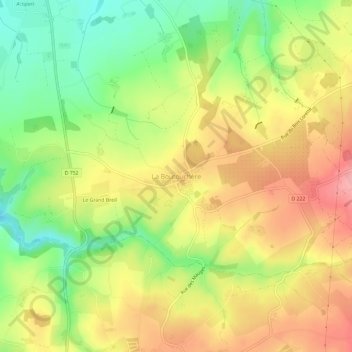
Name: La Boutouchère topographic map, elevation, terrain.
Average elevation: 72 m
Minimum elevation: 14 m
Maximum elevation: 126 m
Thank you for supporting this site ❤️
Make a donation
Make a donation
Other topographic maps
Click on a map to view its topography, its elevation and its terrain.
Le Mesnil-en-Vallée
France > Pays de la Loire > Maine-et-Loire > Mauges-sur-Loire
Average elevation: 43 m