
Cabaiguán topographic map
Interactive map
Click on the map to display elevation.
About this map
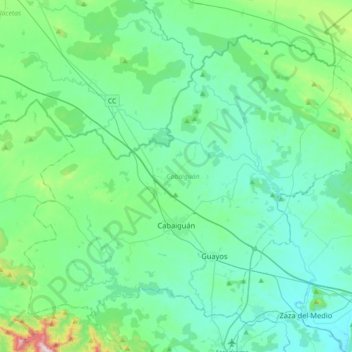
Name: Cabaiguán topographic map, elevation, terrain.
Location: Cabaiguán, Sancti Spíritus, Cuba (21.99339 -79.65369 22.25743 -79.29821)
Average elevation: 142 m
Minimum elevation: 34 m
Maximum elevation: 715 m
Other topographic maps
Click on a map to view its topography, its elevation and its terrain.