
Oxford Heights topographic map
Interactive map
Click on the map to display elevation.
About this map
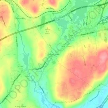
Name: Oxford Heights topographic map, elevation, terrain.
Location: Oxford Heights, Worcester, Massachusetts, 01537, USA (42.15371 -71.89868 42.19371 -71.85868)
Average elevation: 209 m
Minimum elevation: 157 m
Maximum elevation: 266 m