
Casteldebole topographic map
Click on the map to display elevation.
About this map
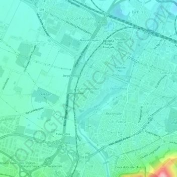
Name: Casteldebole topographic map, elevation, terrain.
Location: Casteldebole, Bologna, Emilia-Romagna, 40132, Italia (44.48355 11.25869 44.52355 11.29869)
Average elevation: 52 m
Minimum elevation: 23 m
Maximum elevation: 201 m
Other topographic maps
Click on a map to view its topography, its elevation and its terrain.