
Thank you for supporting this site ❤️
Make a donation
Make a donation
Saharidj topographic map
Click on the map to display elevation.
Thank you for supporting this site ❤️
Make a donation
Make a donation
About this map
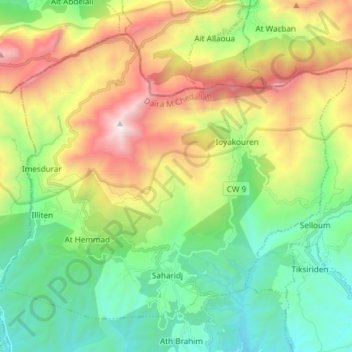
Name: Saharidj topographic map, elevation, terrain.
Location: Saharidj, M'Chedallah District, Bouira, Algeria (36.38235 4.17568 36.47957 4.32477)
Average elevation: 1,056 m
Minimum elevation: 385 m
Maximum elevation: 2,288 m
Thank you for supporting this site ❤️
Make a donation
Make a donation
Other topographic maps
Click on a map to view its topography, its elevation and its terrain.