
Thank you for supporting this site ❤️
Make a donation
Make a donation
Rumuruti topographic map
Click on the map to display elevation.
Thank you for supporting this site ❤️
Make a donation
Make a donation
About this map
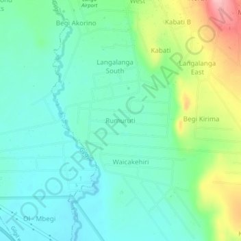
Name: Rumuruti topographic map, elevation, terrain.
Location: Rumuruti, Morendat ward, Gilgil, Nakuru, Rift Valley, Kenya (-0.54790 36.34314 -0.50790 36.38314)
Average elevation: 1,986 m
Minimum elevation: 1,944 m
Maximum elevation: 2,096 m
Thank you for supporting this site ❤️
Make a donation
Make a donation