
Thank you for supporting this site ❤️
Make a donation
Make a donation
Huckleberry Mountain topographic map
Click on the map to display elevation.
Thank you for supporting this site ❤️
Make a donation
Make a donation
About this map
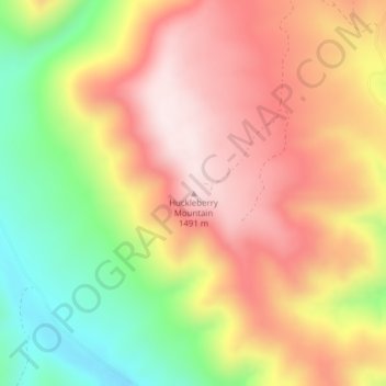
Name: Huckleberry Mountain topographic map, elevation, terrain.
Location: Huckleberry Mountain, Union County, Oregon, United States (45.61842 -118.04638 45.61852 -118.04628)
Average elevation: 1,279 m
Minimum elevation: 1,010 m
Maximum elevation: 1,496 m
Thank you for supporting this site ❤️
Make a donation
Make a donation
Other topographic maps
Click on a map to view its topography, its elevation and its terrain.