
Thank you for supporting this site ❤️
Make a donation
Make a donation
Iron Mountain topographic map
Click on the map to display elevation.
Thank you for supporting this site ❤️
Make a donation
Make a donation
About this map
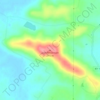
Name: Iron Mountain topographic map, elevation, terrain.
Location: Iron Mountain, Logan County, Kentucky, 42256, United States (37.02833 -86.93671 37.02843 -86.93661)
Average elevation: 149 m
Minimum elevation: 121 m
Maximum elevation: 215 m
Thank you for supporting this site ❤️
Make a donation
Make a donation
Other topographic maps
Click on a map to view its topography, its elevation and its terrain.