
Bibb County topographic map
Interactive map
Click on the map to display elevation.
About this map
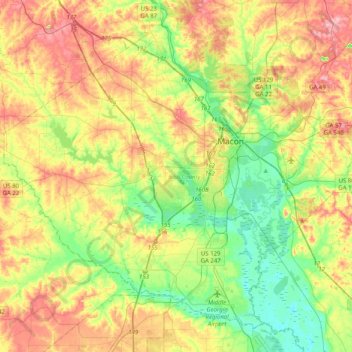
Name: Bibb County topographic map, elevation, terrain.
Location: Bibb County, Georgia, United States of America (32.66064 -83.89205 32.95287 -83.48943)
Average elevation: 128 m
Minimum elevation: 69 m
Maximum elevation: 207 m
Other topographic maps
Click on a map to view its topography, its elevation and its terrain.
Evans County
United States of America > Georgia
Evans County, Georgia, United States of America
Average elevation: 47 m
Murray County
United States of America > Georgia
Murray County, Georgia, United States of America
Average elevation: 381 m
Coffee County
United States of America > Georgia
Coffee County, Georgia, United States of America
Average elevation: 72 m