
Costa Bugni topographic map
Click on the map to display elevation.
About this map
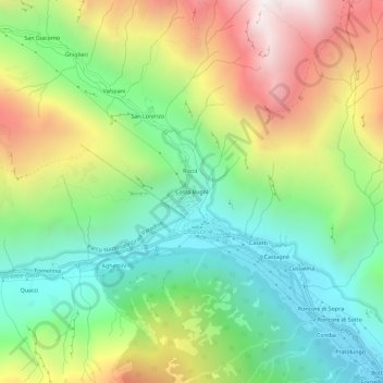
Name: Costa Bugni topographic map, elevation, terrain.
Location: Costa Bugni, Rosone, Locana, Torino, Piedmont, Italy (45.41878 7.39763 45.45878 7.43763)
Average elevation: 1,230 m
Minimum elevation: 620 m
Maximum elevation: 2,189 m