
Thank you for supporting this site ❤️
Make a donation
Make a donation
Ithorots topographic map
Click on the map to display elevation.
Thank you for supporting this site ❤️
Make a donation
Make a donation
About this map
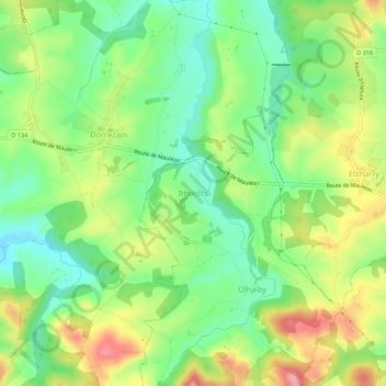
Name: Ithorots topographic map, elevation, terrain.
Average elevation: 121 m
Minimum elevation: 68 m
Maximum elevation: 197 m
Thank you for supporting this site ❤️
Make a donation
Make a donation
Other topographic maps
Click on a map to view its topography, its elevation and its terrain.
Domezain-Berraute
France > Nouvelle-Aquitaine > Pyrénées-Atlantiques > Domezain
Average elevation: 113 m