
Thank you for supporting this site ❤️
Make a donation
Make a donation
Satefal topographic map
Click on the map to display elevation.
Thank you for supporting this site ❤️
Make a donation
Make a donation
About this map
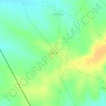
Name: Satefal topographic map, elevation, terrain.
Location: Satefal, Hinganghat, Wardha, Maharashtra, India (20.46705 78.84485 20.50705 78.88485)
Average elevation: 229 m
Minimum elevation: 215 m
Maximum elevation: 245 m
Thank you for supporting this site ❤️
Make a donation
Make a donation