
Thank you for supporting this site ❤️
Make a donation
Make a donation
Malekhu topographic map
Click on the map to display elevation.
Thank you for supporting this site ❤️
Make a donation
Make a donation
About this map
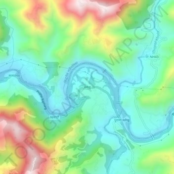
Name: Malekhu topographic map, elevation, terrain.
Location: Malekhu, Benighat Rorang, Dhading, Bagmati Pradesh, Nepal (27.79371 84.80724 27.83371 84.84724)
Average elevation: 550 m
Minimum elevation: 333 m
Maximum elevation: 1,028 m
Thank you for supporting this site ❤️
Make a donation
Make a donation