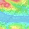
Harvey Rural Community topographic map
Click on the map to display elevation.
About this map

Name: Harvey Rural Community topographic map, elevation, terrain.
Location: Harvey Rural Community, York County, New Brunswick, Canada (45.50068 -67.23552 45.92706 -66.86367)
Average elevation: 132 m
Minimum elevation: 28 m
Maximum elevation: 310 m
Other topographic maps
Click on a map to view its topography, its elevation and its terrain.