
Thank you for supporting this site ❤️
Make a donation
Make a donation
West Delta topographic map
Click on the map to display elevation.
Thank you for supporting this site ❤️
Make a donation
Make a donation
About this map
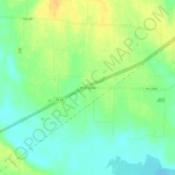
Name: West Delta topographic map, elevation, terrain.
Location: West Delta, Delta County, Texas, 75448, United States (33.30817 -95.80413 33.34817 -95.76413)
Average elevation: 144 m
Minimum elevation: 131 m
Maximum elevation: 159 m
Thank you for supporting this site ❤️
Make a donation
Make a donation