
Strohwolln topographic map
Interactive map
Click on the map to display elevation.
About this map
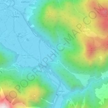
Name: Strohwolln topographic map, elevation, terrain.
Average elevation: 958 m
Minimum elevation: 619 m
Maximum elevation: 1,877 m
Other topographic maps
Click on a map to view its topography, its elevation and its terrain.
Sankt Martin bei Lofer
Österreich > Salzburg > Bezirk Zell am See > Gemeinde Sankt Martin bei Lofer > Sankt Martin bei Lofer
Sankt Martin bei Lofer, Gemeinde Sankt Martin bei Lofer, Bezirk Zell am See, Salzburg, 5092, Österreich
Average elevation: 913 m