
Thank you for supporting this site ❤️
Make a donation
Make a donation
Centerville topographic map
Click on the map to display elevation.
Thank you for supporting this site ❤️
Make a donation
Make a donation
About this map
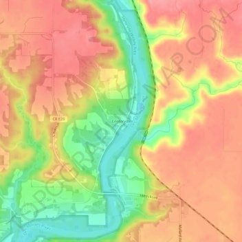
Name: Centerville topographic map, elevation, terrain.
Location: Centerville, Boone County, Iowa, United States (42.07276 -93.95551 42.11276 -93.91551)
Average elevation: 314 m
Minimum elevation: 257 m
Maximum elevation: 352 m
Thank you for supporting this site ❤️
Make a donation
Make a donation
Other topographic maps
Click on a map to view its topography, its elevation and its terrain.