
دهستان کرکس topographic map
Interactive map
Click on the map to display elevation.
About this map
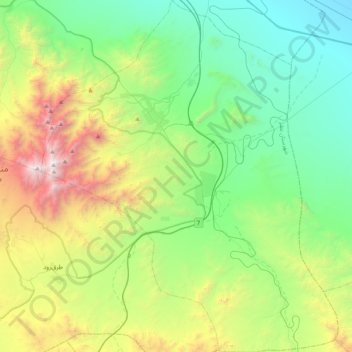
Name: دهستان کرکس topographic map, elevation, terrain.
Location: دهستان کرکس, بخش مرکزی, Natanz County, Isfahan Province, Iran (33.26732 51.78534 33.61965 52.14171)
Average elevation: 1,806 m
Minimum elevation: 980 m
Maximum elevation: 3,857 m
Other topographic maps
Click on a map to view its topography, its elevation and its terrain.
Natanz
Iran > Isfahan Province > Natanz County > دهستان کرکس
Natanz, دهستان کرکس, بخش مرکزی, Natanz County, Isfahan Province, Iran
Average elevation: 1,755 m