
Thank you for supporting this site ❤️
Make a donation
Make a donation
Banao topographic map
Click on the map to display elevation.
Thank you for supporting this site ❤️
Make a donation
Make a donation
About this map
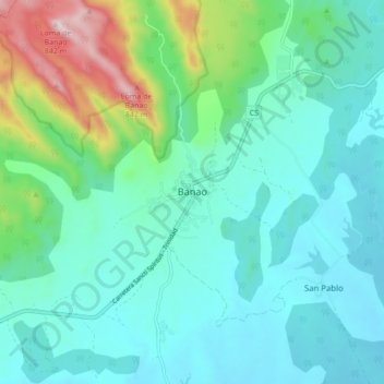
Name: Banao topographic map, elevation, terrain.
Location: Banao, Sancti Spiritus, Cuba (21.78707 -79.60748 21.86707 -79.52748)
Average elevation: 204 m
Minimum elevation: 51 m
Maximum elevation: 797 m
Thank you for supporting this site ❤️
Make a donation
Make a donation