
Cortil-Noirmont topographic map
Interactive map
Click on the map to display elevation.
About this map
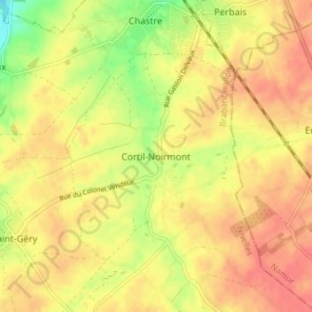
Name: Cortil-Noirmont topographic map, elevation, terrain.
Average elevation: 148 m
Minimum elevation: 113 m
Maximum elevation: 168 m
Other topographic maps
Click on a map to view its topography, its elevation and its terrain.
Le Perbais
Le Perbais, Chastre, Nivelles, Brabant wallon, Wallonie, 1450, Belgique
Average elevation: 142 m