
Make a donation
Cypress Lakes topographic map
Click on the map to display elevation.
Make a donation
About this map
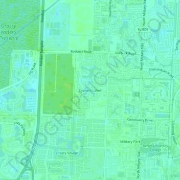
Name: Cypress Lakes topographic map, elevation, terrain.
Average elevation: 9 m
Minimum elevation: 4 m
Maximum elevation: 14 m
Make a donation
Other topographic maps
Click on a map to view its topography, its elevation and its terrain.
Palm Beach
United States > Florida > Palm Beach County
Palm Beach is one of the easternmost towns in Florida, though the state's easternmost point is in Palm Beach Shores, just north of Lake Worth Inlet. The town is on an 18-mile (29 km) long barrier island between the Intracoastal Waterway (locally known as the Lake Worth Lagoon) on the west and the Atlantic…
Average elevation: 4 m
Loxahatchee Groves
United States > Florida > Palm Beach County
The area now known as Loxahatchee Groves was originally a portion of the 2,000,000 acres (8,100 km2) of land purchased by the Southern States Land and Timber Company in 1902. After the West Palm Beach Canal (C-51), which connected Lake Okeechobee at Canal Point to West Palm Beach, was completed in 1917, George…
Average elevation: 9 m
Make a donation
Make a donation