
Thank you for supporting this site ❤️
Make a donation
Make a donation
Tanagan topographic map
Click on the map to display elevation.
Thank you for supporting this site ❤️
Make a donation
Make a donation
About this map
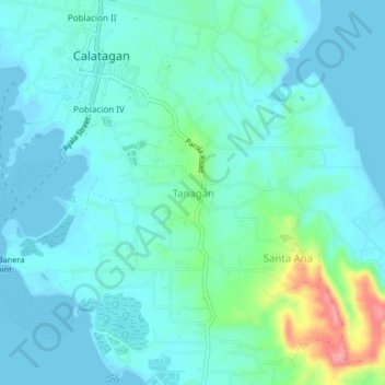
Name: Tanagan topographic map, elevation, terrain.
Location: Tanagan, Calatagan, Batangas, Calabarzon, 4215, Philippines (13.79870 120.62206 13.83870 120.66206)
Average elevation: 18 m
Minimum elevation: -1 m
Maximum elevation: 99 m
Thank you for supporting this site ❤️
Make a donation
Make a donation
Other topographic maps
Click on a map to view its topography, its elevation and its terrain.