Geolocate

Temple Guiting topographic map

Interactive map

Click on the map to display elevation.

About this map

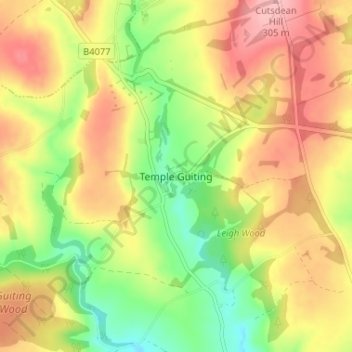
Name: Temple Guiting topographic map, elevation, terrain.

Location: Temple Guiting, Cotswold District, Gloucestershire, England, GL54 5RP, United Kingdom (51.93125 -1.88777 51.97125 -1.84777)

Average elevation: 241 m

Minimum elevation: 174 m

Maximum elevation: 305 m

Other topographic maps

Click on a map to view its topography, its elevation and its terrain.

Thames Head

United Kingdom > England > Gloucestershire > Cotswold District > Kemble

Thames Head, Kemble, Cotswold District, Gloucestershire, England, GL7 6NZ, United Kingdom

Average elevation: 117 m

Upper Rissington

United Kingdom > England > Gloucestershire > Cotswold District

Upper Rissington, Cotswold District, Gloucestershire, England, GL54 2NN, United Kingdom

Average elevation: 184 m