
Thank you for supporting this site ❤️
Make a donation
Make a donation
Asalem topographic map
Click on the map to display elevation.
Thank you for supporting this site ❤️
Make a donation
Make a donation
About this map
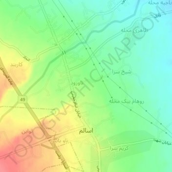
Name: Asalem topographic map, elevation, terrain.
Location: Asalem, بخش اسالم, Talesh County, Gilan Province, Iran (37.71769 48.94885 37.73731 48.96226)
Average elevation: 34 m
Minimum elevation: 6 m
Maximum elevation: 72 m
Thank you for supporting this site ❤️
Make a donation
Make a donation
Other topographic maps
Click on a map to view its topography, its elevation and its terrain.