
Thank you for supporting this site ❤️
Make a donation
Make a donation
San Jacinto topographic map
Click on the map to display elevation.
Thank you for supporting this site ❤️
Make a donation
Make a donation
About this map
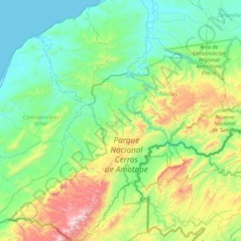
Name: San Jacinto topographic map, elevation, terrain.
Location: San Jacinto, Tumbes, Perú (-4.23190 -80.66645 -3.62292 -80.39803)
Average elevation: 354 m
Minimum elevation: 0 m
Maximum elevation: 1,584 m
Thank you for supporting this site ❤️
Make a donation
Make a donation
Other topographic maps
Click on a map to view its topography, its elevation and its terrain.