
Thank you for supporting this site ❤️
Make a donation
Make a donation
Parkersburg topographic map
Click on the map to display elevation.
Thank you for supporting this site ❤️
Make a donation
Make a donation
About this map
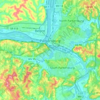
Name: Parkersburg topographic map, elevation, terrain.
Location: Parkersburg, Wood County, West Virginia, United States (39.20423 -81.58083 39.30938 -81.50273)
Average elevation: 213 m
Minimum elevation: 177 m
Maximum elevation: 308 m
Thank you for supporting this site ❤️
Make a donation
Make a donation
Other topographic maps
Click on a map to view its topography, its elevation and its terrain.
Thank you for supporting this site ❤️
Make a donation
Make a donation
Thank you for supporting this site ❤️
Make a donation
Make a donation