
Nadrin topographic map
Interactive map
Click on the map to display elevation.
About this map
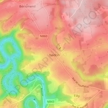
Name: Nadrin topographic map, elevation, terrain.
Location: Nadrin, Houffalize, Luxembourg, Wallonie, 6982, Belgique (50.14081 5.66092 50.18081 5.70092)
Average elevation: 389 m
Minimum elevation: 241 m
Maximum elevation: 479 m