Geolocate

York Region topographic map

Click on the map to display elevation.

About this map

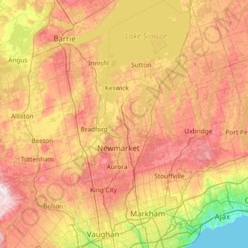
Name: York Region topographic map, elevation, terrain.

Location: York Region, Golden Horseshoe, Ontario, Canada (43.74984 -79.77550 44.50486 -79.15613)

Average elevation: 243 m

Minimum elevation: 73 m

Maximum elevation: 463 m

Other topographic maps

Click on a map to view its topography, its elevation and its terrain.

Windsor

Canada > Ontario > Windsor

Average elevation: 185 m

Kingston

Canada > Ontario > Kingston

Average elevation: 94 m

Port Rowan

Canada > Ontario > Norfolk County

Average elevation: 182 m

Halton Hills

Canada > Ontario > Halton Region

Average elevation: 287 m

Keewatin Park

Canada > Ontario > Durham Region > Oshawa

Average elevation: 117 m

Milligan's Pond

Canada > Ontario > Barrie

Average elevation: 238 m

Chatham

Canada > Ontario > Chatham-Kent

Average elevation: 184 m