
Thank you for supporting this site ❤️
Make a donation
Make a donation
Bloomingdale topographic map
Click on the map to display elevation.
Thank you for supporting this site ❤️
Make a donation
Make a donation
About this map
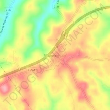
Name: Bloomingdale topographic map, elevation, terrain.
Location: Bloomingdale, Jefferson County, Ohio, United States (40.33897 -80.82291 40.34694 -80.81442)
Average elevation: 357 m
Minimum elevation: 286 m
Maximum elevation: 409 m
Thank you for supporting this site ❤️
Make a donation
Make a donation
Other topographic maps
Click on a map to view its topography, its elevation and its terrain.