
Thank you for supporting this site ❤️
Make a donation
Make a donation
Chardon Township topographic map
Click on the map to display elevation.
Thank you for supporting this site ❤️
Make a donation
Make a donation
About this map
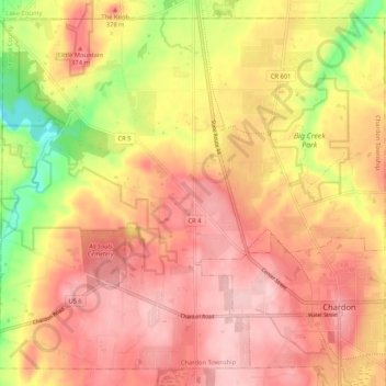
Name: Chardon Township topographic map, elevation, terrain.
Location: Chardon Township, Geauga County, Ohio, United States (41.56988 -81.29574 41.64125 -81.19099)
Average elevation: 353 m
Minimum elevation: 249 m
Maximum elevation: 412 m
Thank you for supporting this site ❤️
Make a donation
Make a donation
Other topographic maps
Click on a map to view its topography, its elevation and its terrain.