
Thank you for supporting this site ❤️
Make a donation
Make a donation
Rohani topographic map
Click on the map to display elevation.
Thank you for supporting this site ❤️
Make a donation
Make a donation
About this map
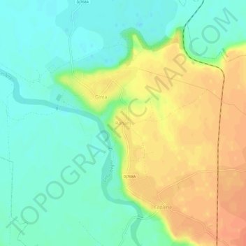
Name: Rohani topographic map, elevation, terrain.
Location: Rohani, Bihor, 417132, Roumanie (46.72911 22.07328 46.76911 22.11328)
Average elevation: 140 m
Minimum elevation: 122 m
Maximum elevation: 163 m
Thank you for supporting this site ❤️
Make a donation
Make a donation