Geolocate

Parque Provincial Copahue - Caviahue topographic map

Interactive map

Click on the map to display elevation.

About this map

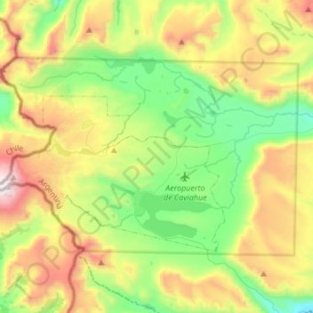
Name: Parque Provincial Copahue - Caviahue topographic map, elevation, terrain.

Location: Parque Provincial Copahue - Caviahue, RP26, Lafontaine, Departamento Ñorquín, NQN, 8349, Argentina (-37.90634 -71.18343 -37.77115 -70.91412)

Average elevation: 1,902 m

Minimum elevation: 1,312 m

Maximum elevation: 2,943 m

Other topographic maps

Click on a map to view its topography, its elevation and its terrain.

Neuquén

Argentina > NQN > Neuquén

Neuquén, Departamento Confluencia, NQN, Argentina

Average elevation: 289 m

Volcán Domuyo

Argentina > NQN

Volcán Domuyo, Departamento Chos Malal, NQN, Argentina

Average elevation: 4,229 m

Cerro Mocho

Argentina > NQN

Cerro Mocho, Departamento Lácar, NQN, Argentina

Average elevation: 1,137 m