
Celendín topographic map
Interactive map
Click on the map to display elevation.
Celendín
Celendín ist eine Stadt im Nordwesten von Peru. Sie liegt im Osten der Region Cajamarca und ist der Verwaltungssitz der Provinz Celendín und des Distrikts Celendín. Die Stadt liegt 13 km westlich des Río Marañón auf einer Höhe von 2645 m. Die Einwohnerzahl betrug beim Zensus 2017 19.809. 10 Jahre zuvor lag sie bei 16.721.
About this map
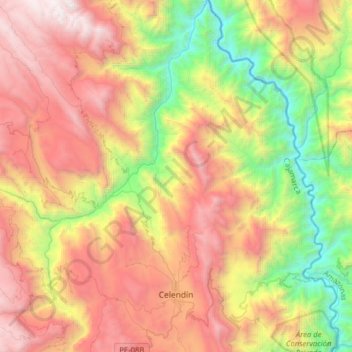
Name: Celendín topographic map, elevation, terrain.
Location: Celendín, Cajamarca, Peru (-6.91669 -78.21495 -6.60272 -78.01406)
Average elevation: 2,269 m
Minimum elevation: 762 m
Maximum elevation: 3,973 m