
Thank you for supporting this site ❤️
Make a donation
Make a donation
Zaltbommel topographic map
Click on the map to display elevation.
Thank you for supporting this site ❤️
Make a donation
Make a donation
About this map
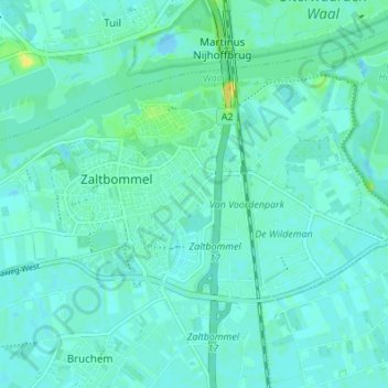
Name: Zaltbommel topographic map, elevation, terrain.
Location: Zaltbommel, Gelderland, Nederland (51.78894 5.22045 51.82121 5.28844)
Average elevation: 4 m
Minimum elevation: -8 m
Maximum elevation: 19 m
Thank you for supporting this site ❤️
Make a donation
Make a donation