
Niederbichl topographic map
Interactive map
Click on the map to display elevation.
About this map
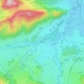
Name: Niederbichl topographic map, elevation, terrain.
Average elevation: 721 m
Minimum elevation: 582 m
Maximum elevation: 1,159 m
Other topographic maps
Click on a map to view its topography, its elevation and its terrain.
Erlau
Österreich > Tirol > Bezirk Kitzbühel > Gemeinde Kössen > Kössen
Erlau, Kössen, Gemeinde Kössen, Bezirk Kitzbühel, Tirol, 6345, Österreich
Average elevation: 723 m
Thurnbichl
Österreich > Tirol > Bezirk Kitzbühel > Gemeinde Kössen
Thurnbichl, Gemeinde Kössen, Bezirk Kitzbühel, Tirol, 6345, Österreich
Average elevation: 699 m