
Thank you for supporting this site ❤️
Make a donation
Make a donation
Barnsdall topographic map
Click on the map to display elevation.
Thank you for supporting this site ❤️
Make a donation
Make a donation
About this map
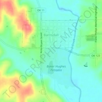
Name: Barnsdall topographic map, elevation, terrain.
Location: Barnsdall, Osage County, Oklahoma, 74002, United States (36.54480 -96.17213 36.56764 -96.14311)
Average elevation: 236 m
Minimum elevation: 214 m
Maximum elevation: 282 m
Thank you for supporting this site ❤️
Make a donation
Make a donation
Other topographic maps
Click on a map to view its topography, its elevation and its terrain.