
Atlantis topographic map
Click on the map to display elevation.
About this map
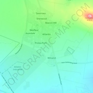
Name: Atlantis topographic map, elevation, terrain.
Location: Atlantis, City of Cape Town, Western Cape, South Africa (-33.61411 18.45315 -33.53984 18.51740)
Average elevation: 162 m
Minimum elevation: 99 m
Maximum elevation: 413 m
Other topographic maps
Click on a map to view its topography, its elevation and its terrain.
Cathkin Park
South Africa > Western Cape > City of Cape Town > Mitchells Plain
Average elevation: 15 m