
Thank you for supporting this site ❤️
Make a donation
Make a donation
Saint Wendel topographic map
Click on the map to display elevation.
Thank you for supporting this site ❤️
Make a donation
Make a donation
About this map
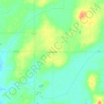
Name: Saint Wendel topographic map, elevation, terrain.
Location: Saint Wendel, Stearns County, Minnesota, United States (45.64608 -94.39778 45.68608 -94.35778)
Average elevation: 361 m
Minimum elevation: 344 m
Maximum elevation: 387 m
Thank you for supporting this site ❤️
Make a donation
Make a donation
Other topographic maps
Click on a map to view its topography, its elevation and its terrain.