
Thank you for supporting this site ❤️
Make a donation
Make a donation
Prijevor topographic map
Click on the map to display elevation.
Thank you for supporting this site ❤️
Make a donation
Make a donation
About this map
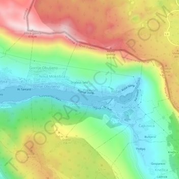
Name: Prijevor topographic map, elevation, terrain.
Location: Prijevor, Dubrovnik, Dubrovnik-Neretva County, 20236, Croatia (42.65342 18.10165 42.69342 18.14165)
Average elevation: 248 m
Minimum elevation: -4 m
Maximum elevation: 603 m
Thank you for supporting this site ❤️
Make a donation
Make a donation
Other topographic maps
Click on a map to view its topography, its elevation and its terrain.