
Thank you for supporting this site ❤️
Make a donation
Make a donation
Hanwatkhed topographic map
Click on the map to display elevation.
Thank you for supporting this site ❤️
Make a donation
Make a donation
About this map
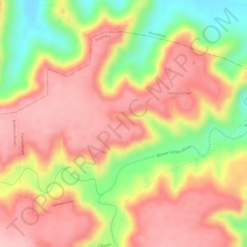
Name: Hanwatkhed topographic map, elevation, terrain.
Location: Hanwatkhed, Buldhana, Maharashtra, India (20.54670 76.20449 20.56710 76.23361)
Average elevation: 573 m
Minimum elevation: 461 m
Maximum elevation: 638 m
Thank you for supporting this site ❤️
Make a donation
Make a donation