
Thank you for supporting this site ❤️
Make a donation
Make a donation
Reddicap Heath topographic map
Click on the map to display elevation.
Thank you for supporting this site ❤️
Make a donation
Make a donation
About this map
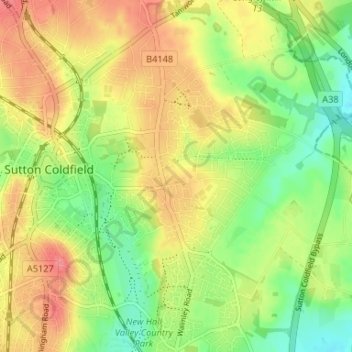
Name: Reddicap Heath topographic map, elevation, terrain.
Average elevation: 121 m
Minimum elevation: 88 m
Maximum elevation: 154 m
Thank you for supporting this site ❤️
Make a donation
Make a donation
Other topographic maps
Click on a map to view its topography, its elevation and its terrain.
Black Pool
United Kingdom > England > Birmingham > Sutton Coldfield > Tyburn > Walmley Ash
Average elevation: 95 m
Springhill Plantation
United Kingdom > England > Birmingham > Sutton Coldfield
Average elevation: 146 m