
Thank you for supporting this site ❤️
Make a donation
Make a donation
Pondera County topographic map
Click on the map to display elevation.
Thank you for supporting this site ❤️
Make a donation
Make a donation
About this map
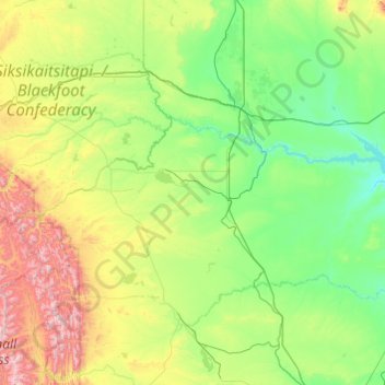
Name: Pondera County topographic map, elevation, terrain.
Location: Pondera County, Montana, United States (47.98410 -113.35000 48.48389 -111.40891)
Average elevation: 1,242 m
Minimum elevation: 903 m
Maximum elevation: 2,788 m
Thank you for supporting this site ❤️
Make a donation
Make a donation
Other topographic maps
Click on a map to view its topography, its elevation and its terrain.