
Anmore topographic map
Click on the map to display elevation.
About this map
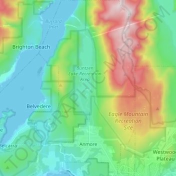
Name: Anmore topographic map, elevation, terrain.
Average elevation: 346 m
Minimum elevation: -1 m
Maximum elevation: 1,237 m
Other topographic maps
Click on a map to view its topography, its elevation and its terrain.
Sugar Mountain
Canada > British Columbia > Metro Vancouver Regional District > Anmore
Average elevation: 180 m