
Thank you for supporting this site ❤️
Make a donation
Make a donation
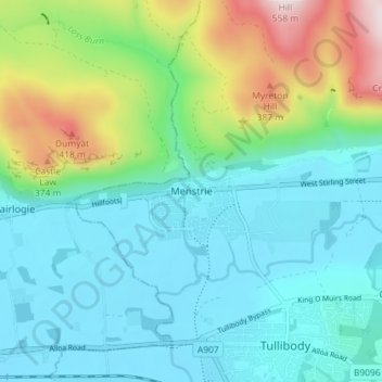
Menstrie topographic map
Click on the map to display elevation.
Thank you for supporting this site ❤️
Make a donation
Make a donation
Menstrie
Menstrie stands on the carse or flood plain of the River Devon, between 10 and 20 metres altitude above sea level. It is roughly astride the Ochil Fault whose movement gave rise to the dramatic southern scarp of the Ochils but which is now almost quiescent.
Thank you for supporting this site ❤️
Make a donation
Make a donation
About this map
Name: Menstrie topographic map, elevation, terrain.
Location: Menstrie, Clackmannanshire, Scotland, FK11 7BL, United Kingdom (56.13142 -3.87377 56.17142 -3.83377)
Average elevation: 129 m
Minimum elevation: 3 m
Maximum elevation: 527 m
Thank you for supporting this site ❤️
Make a donation
Make a donation
Other topographic maps
Click on a map to view its topography, its elevation and its terrain.