
Thank you for supporting this site ❤️
Make a donation
Make a donation
St. Clairsville topographic map
Click on the map to display elevation.
Thank you for supporting this site ❤️
Make a donation
Make a donation
About this map
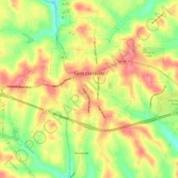
Name: St. Clairsville topographic map, elevation, terrain.
Location: St. Clairsville, Belmont County, Ohio, 43950, United States (40.05698 -80.92667 40.09718 -80.87535)
Average elevation: 355 m
Minimum elevation: 302 m
Maximum elevation: 397 m
Thank you for supporting this site ❤️
Make a donation
Make a donation
Other topographic maps
Click on a map to view its topography, its elevation and its terrain.