
Thank you for supporting this site ❤️
Make a donation
Make a donation
Druid Hills topographic map
Click on the map to display elevation.
Thank you for supporting this site ❤️
Make a donation
Make a donation
About this map
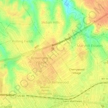
Name: Druid Hills topographic map, elevation, terrain.
Location: Druid Hills, Jefferson County, Kentucky, United States (38.26195 -85.66587 38.26729 -85.65782)
Average elevation: 169 m
Minimum elevation: 143 m
Maximum elevation: 181 m
Thank you for supporting this site ❤️
Make a donation
Make a donation
Other topographic maps
Click on a map to view its topography, its elevation and its terrain.