
Sare topographic map
Click on the map to display elevation.
About this map
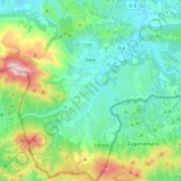
Name: Sare topographic map, elevation, terrain.
Average elevation: 227 m
Minimum elevation: 10 m
Maximum elevation: 886 m
Other topographic maps
Click on a map to view its topography, its elevation and its terrain.
Les Eschartès
France > Nouvelle-Aquitaine > Pyrénées-Atlantiques > Louvie-Soubiron
Average elevation: 942 m