
Kuala Lumpur International Airport topographic map
Interactive map
Click on the map to display elevation.
About this map
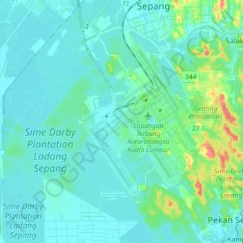
Name: Kuala Lumpur International Airport topographic map, elevation, terrain.
Location: Kuala Lumpur International Airport, Selangor, 64000, Malaysia (2.67992 101.63308 2.80350 101.74904)
Average elevation: 13 m
Minimum elevation: -1 m
Maximum elevation: 88 m
Other topographic maps
Click on a map to view its topography, its elevation and its terrain.
Pulau Indah
Malaysia > Selangor > Klang Municipal Council
Pulau Indah, Klang Municipal Council, Klang, Selangor, 42920, Malaysia
Average elevation: 3 m
Bandar Baru Bangi
Malaysia > Selangor > Kajang Municipal Council
Bandar Baru Bangi, Kajang Municipal Council, Hulu Langat, Selangor, Malaysia
Average elevation: 42 m
Ampang Jaya Municipal Council
Ampang Jaya Municipal Council, Hulu Langat, Selangor, Malaysia
Average elevation: 167 m
Kajang Municipal Council
Malaysia > Selangor > Kajang Municipal Council
Kajang Municipal Council, Hulu Langat, Selangor, Malaysia
Average elevation: 198 m
Kampung Atap
Malaysia > Selangor > Klang Municipal Council > Kampung Atap
Kampung Atap, Klang Municipal Council, Klang, Selangor, 41400, Malaysia
Average elevation: 7 m
Pulau Indah
Malaysia > Selangor > Klang Municipal Council
Pulau Indah, Klang Municipal Council, Selangor, Malaysia
Average elevation: 3 m
SS16
Malaysia > Selangor > Subang Jaya > SS16
SS16, Subang Jaya, Selangor, 47500, Malaysia
Average elevation: 34 m
Section 19
Malaysia > Selangor > SA > Section 19
Section 19, SA, Selangor, 40200, Malaysia
Average elevation: 10 m
Pangsapuri Jasmin
Malaysia > Selangor > SA > Pangsapuri Jasmin
Pangsapuri Jasmin, SA, Selangor, 40160, Malaysia
Average elevation: 34 m
Kampung Sungai Raya
Malaysia > Selangor > Kampung Sungai Raya
Kampung Sungai Raya, Selangor, 43100, Malaysia
Average elevation: 68 m
Langat River
Langat River, Klang, Selangor, 42600, Malaysia
Average elevation: 4 m
Bandar Baru Bangi
Malaysia > Selangor > Kajang Municipal Council > Bandar Baru Bangi
Bandar Baru Bangi, Kajang Municipal Council, Hulu Langat, Selangor, 43650, Malaysia
Average elevation: 47 m
Kuala Selangor
Malaysia > Selangor > Kuala Selangor
Kuala Selangor, Selangor, 45000, Malaysia
Average elevation: 3 m
Subang Jaya
Malaysia > Selangor > Subang Jaya
Subang Jaya, Selangor, 47610, Malaysia
Average elevation: 35 m