
Thank you for supporting this site ❤️
Make a donation
Make a donation
Râu de Mori topographic map
Click on the map to display elevation.
Thank you for supporting this site ❤️
Make a donation
Make a donation
About this map
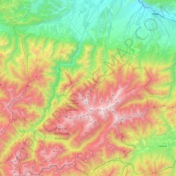
Name: Râu de Mori topographic map, elevation, terrain.
Location: Râu de Mori, Hunedoara, Romania (45.25128 22.65659 45.55558 22.92616)
Average elevation: 1,228 m
Minimum elevation: 323 m
Maximum elevation: 2,491 m
Thank you for supporting this site ❤️
Make a donation
Make a donation
Other topographic maps
Click on a map to view its topography, its elevation and its terrain.