
Thank you for supporting this site ❤️
Make a donation
Make a donation
Sila topographic map
Click on the map to display elevation.
Thank you for supporting this site ❤️
Make a donation
Make a donation
About this map
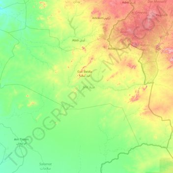
Name: Sila topographic map, elevation, terrain.
Location: Sila, Chad (10.91972 19.88900 13.05900 22.97528)
Average elevation: 544 m
Minimum elevation: 398 m
Maximum elevation: 1,220 m
Thank you for supporting this site ❤️
Make a donation
Make a donation
Other topographic maps
Click on a map to view its topography, its elevation and its terrain.